
Kanto
Kanto is the region Tokyo sits in: seven prefectures around the capital holding 43,509,179 people, over a third of Japan, and the centre of its politics and economy. For a visitor it works as one place, with Tokyo as the base and Kamakura, Nikko, Hakone and Yokohama as day trips out and back.
What Kanto is
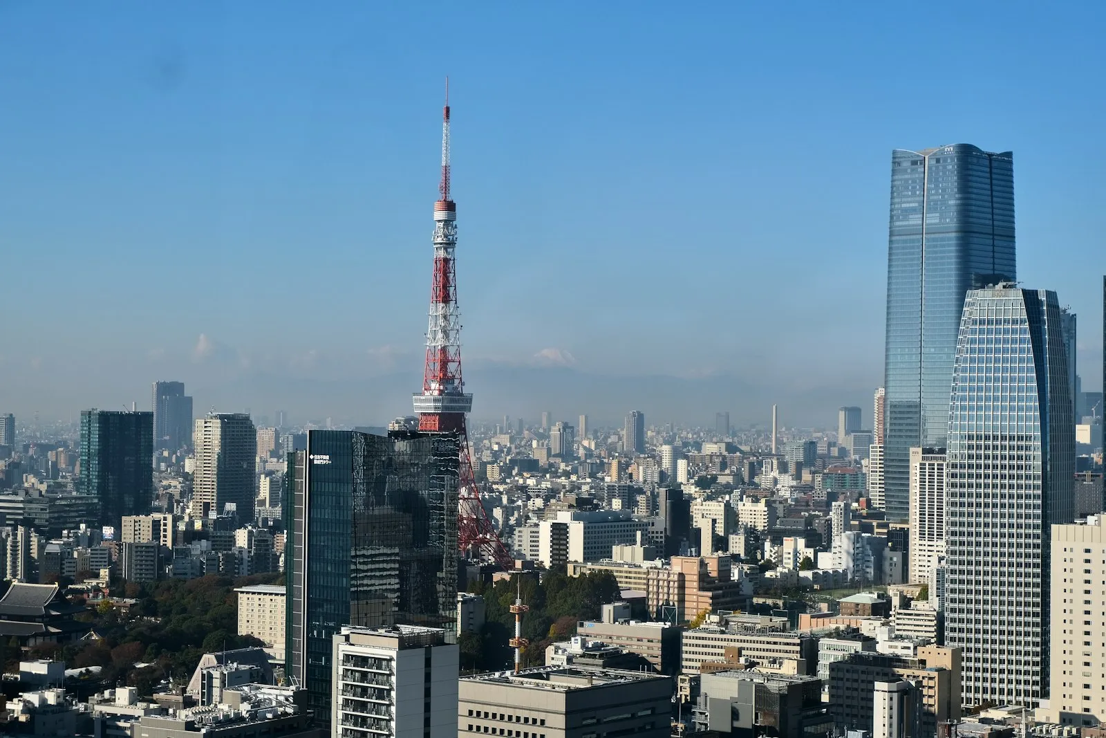
Kanto is the region Tokyo sits in, and it is where more than a third of Japan lives. Seven prefectures make it up: Chiba, Gunma, Ibaraki, Kanagawa, Saitama, Tochigi and Tokyo itself, with 43,509,179 people counted on 1 October 2025. It is the centre of Japanese politics and of the economy, which is why so much of a first trip happens here without anyone planning it that way. The practical shape for a visitor is simple: Tokyo is the base, and the rest of the region is a train ride out and back inside a day.
Tokyo
Tokyo is where you will actually sleep, and the region's whole transport map is built around it. The JR Yamanote loop threads the major hubs together, Tokyo Metro and Toei fill in everything inside the loop, and a Suica or Pasmo IC card pays for all of it with a tap. Station names are romanised and the major signage is bilingual, so moving around reads easily even on day one; menus often are not, which is what the translation camera on your phone is for. Cash still goes a long way at small restaurants and shrines, while cards and contactless are fine in the chains.
The day trips
Four trips come up again and again, and each is a day out of Tokyo. Kamakura, on the coast in Kanagawa, has the Great Buddha and a dense cluster of temples. Nikko, up in Tochigi, has its shrines in a mountain forest, listed by UNESCO. Hakone is the onsen town people go to for Mount Fuji views and a hot bath, and Yokohama is the port city next door with the Chinatown. Take one per day rather than two: they lie in different directions, and the pleasure of each of them is in not rushing it.
The two airports and the Yamanote
Kanto holds both of Tokyo's airports. Narita is 60 km east of the city, and two trains run in from it: the JR Narita Express takes about an hour to Tokyo Station, and the Keisei Skyliner about forty minutes to Ueno. Haneda sits closer in and is Japan's largest domestic airport, so it is the one you are most likely to use for a flight within the country. From either, the Yamanote loop is the line you meet first, and an IC card is the thing to sort before anything else: Suica and Pasmo work on trains, subways and buses nationwide, and at convenience stores and station shops too.
When to go and staying connected
Cherry blossom lands mid-March into April and autumn colour from late October to early December, and both are worth planning a trip around. The rainy tsuyu runs early June to mid-July, typhoon season runs June to December, peaking July to September, and Tokyo in August sits above 31°C on an average day. Winter on the Pacific side is dry and clear, which makes it the quiet season with the best light. Avoid Golden Week in late April and early May, Obon in mid-August and New Year if you can: trains and hotels fill up. Goodbars sells a Japan eSIM you install at home and switch on when you land; which network carries it, and how fast, we publish only once we have verified it ourselves.
Common questions
What is the Kanto region?
The region around Tokyo: seven prefectures, Chiba, Gunma, Ibaraki, Kanagawa, Saitama, Tochigi and Tokyo itself. It counted 43,509,179 people on 1 October 2025, over a third of Japan, and it is the centre of the country's politics and economy.
Which airport will I land at for Tokyo?
Narita or Haneda. Narita is 60 km east of the city, with the JR Narita Express about an hour to Tokyo Station and the Keisei Skyliner about forty minutes to Ueno. Haneda is closer in and is Japan's largest domestic airport.
What are the best day trips from Tokyo?
Kamakura for the Great Buddha and its temples, Nikko for the UNESCO-listed shrines in the mountains, Hakone for Mount Fuji views and onsen, and Yokohama for the port and its Chinatown. One a day works better than two, since they lie in different directions.
When is the best time to visit Kanto?
Mid-March into April for cherry blossom and late October to early December for autumn colour, both busy. Early June to mid-July is the tsuyu rains and June to December the typhoon season, peaking July to September, with Tokyo above 31°C on an average August day. Winter on the Pacific side is dry and clear.
Will my phone work around Kanto?
Tokyo and the day-trip towns are the straightforward part of Japan; for the mountain stretches around Nikko and Hakone, download your maps before you set off anyway. Goodbars sells a Japan eSIM you install at home and switch on when you land; which network carries it, and how fast, we publish only once we have verified it ourselves.
On the map
Install before landingLAND ONLINE
Set up your eSIM at home and step off the plane already connected. No counter, no passport handed over, no queue.
See the plans- No ID needed
- No contract
- Instant email delivery
- Works on arrival